Center for Earth Observation and Digital Earth Chinese Academy of Sciences
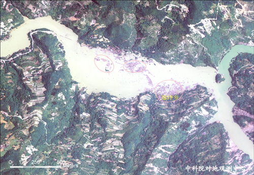
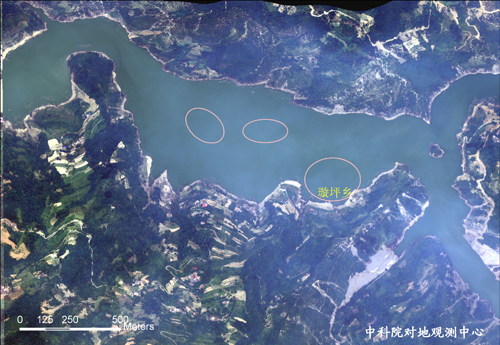
Comparison of the optical remote sensing images of Jianjiang River waterway captured in different time spans
May 16, 2008
May 16, 2009
The Return of CEODE’s Remote Sensing Aircraft Triggered Huge Boost and High Praise
Airborne Remote Sensing Detection of Waterway Change from Yuli to
Xuanping Township of Jianjiang River
CEODE Released Airborne Optical Remote Sensing Data on the Recovery
and Reconstruction Process of Beichuan County
CEODE Published New Airborne Remote Sensing Data on the Progress
of Beichuan Reconostruction
Two Remote Sensing Aircraft Sent to Wenchuan--CEODE's Actions for
the 1st Anniversary of Wenchuan Earthquake
First batch High Resolution Aviation Remote Sensing Data Image Show
post-disaster reconstruction status
The Remote Sensing Monitoring Experiments of Wenchuan Earthquake
Anniversary Activities Conducted by CEODE Aroused the Widespread
Public Concern
Airborne Remote Sensing Monitor of Barrier Lake after the 1st
Anniversary of Wenchuan Earthquake
Airborne Remote Sensing Analysis of the Changes in Maoxian
County, Sichuan Province
Remote Sensing Monitoring of the Reconstruction Status for Yuli
Township, Beichuan County after the 1st Anniversary of the
Earthquake Disaster
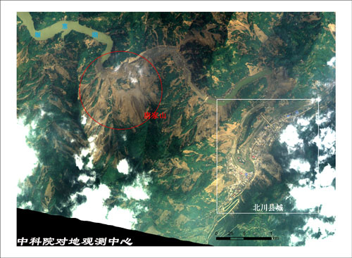
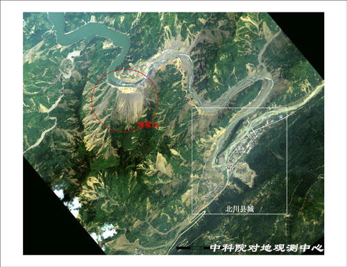
Comparison of the optical remote sensing images of the Tangjiashan-Beichuan County captured in different time spans
May 16, 2008
May 16, 2009
地址:北京市海淀区中关村北一条9号科电大厦
Copyright 2008 中国科学院对地观测与数字地球科学中心 All Rights Reserved